 |
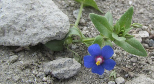
| Blue Variety of Scarlet Pimpernel (Who knew it came like that?) |
I was meeting a friend for lunch in Ibarra on July 15th, so I went early and took a bus to nearby Laguna Yahuarcocha - "Blood Lake" - named for the bloody massacre of local warriors by the conquering Incas, who dumped the bodies of thousands of slain
soldiers into the lake. My walk was a bit more pleasant than
that!
 |
| Yahuarcocha (Blood Lake) |
 |
| There be dragons on the lake... |
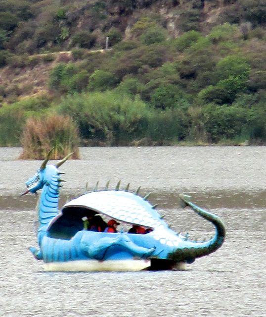 |
| .... with full bellies! |
The next day, the 16th, I had early-morning visitors to the wall by my back window, feasting on a large squash that had been left there.
 |
| Yellow Grosbeak |
Then after breakfast I took a great walk up the old Cuicocha road, gradually gaining elevation as I walked part-way to the crater lake.
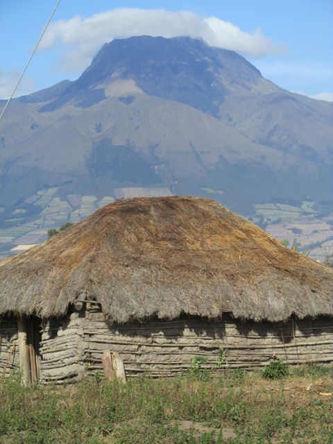 |
| Old hut mimicking the shape of Imbabura |
 |
| Burro and Mountains |
 |
| Cows and Mountains |
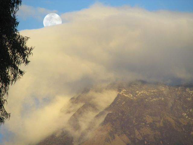
The next evening evening there was another lovely sunset view of the peak of Cotacachi
On the 18th, I led the first official Cotacachi Hikers trip, down into the river ravine that I had scouted out earlier. I have to say that starting the hiking group was a wonderful idea. I've made great new friends and learned many new hiking routes, and the expats here seem to be delighted and grateful to have this new resource.
 |
| The gang for the 1st hike: Bonnie, Kristin, me and Greg. |
When I had first scouted out the ravine, I had turned around when I came to a well-secured barbed-wire gate. This time, though, the gate was open, so we were able to hike farther up the ravine and exit by a different road.
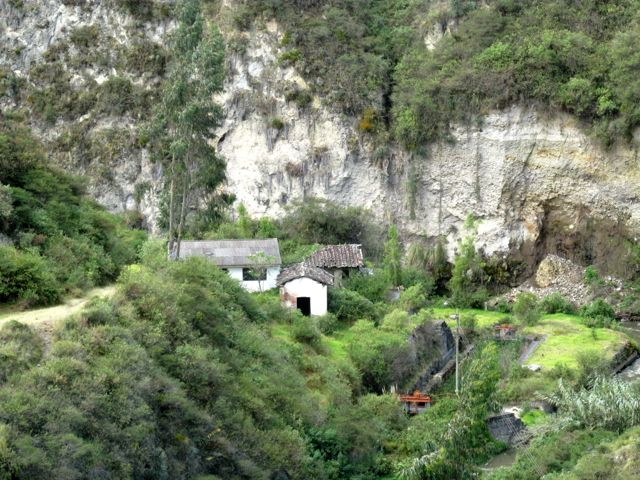 |
| Abandoned homestead in the ravine |
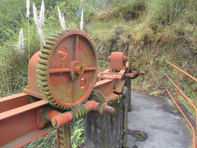 |
| Near the old homestead was a functioning hydro-electric plant as well as old unused irrigation works. I like the shape and colors of the old water diversion mechanisms. |
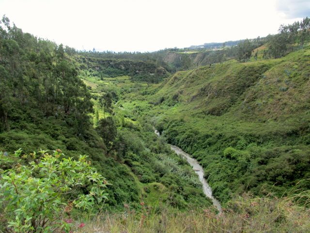 |
| View down the ravine from the road we took up out of the ravine to the pueblo of Calera in order to loop back to Cotacachi. |
After the hike, as I was walking through town, I noticed an indigenous wedding celebration happening in front of the cathedral.
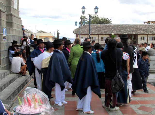 |
| Family and friends were dancing around the bride and groom |
 |
| The younger guy sang about the bride and groom's life together while the older guy played the harp. |
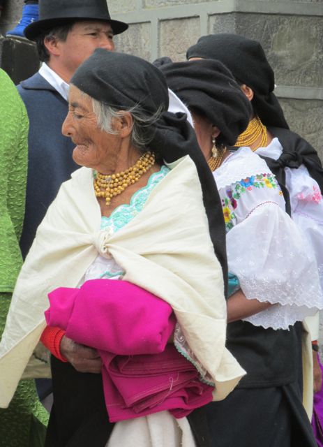 |
| A dancer |
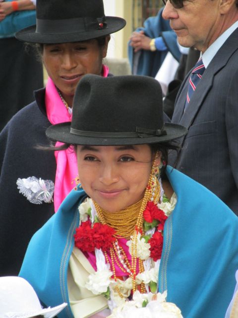 |
| The bride and groom |
Sunday the 19th I spent a lazy morning drinking coffee (from the nearby Intag valley), listening
to music (from Vermont Public radio) and rereading The Color Purple.
Then Monday it was back to hiking! I checked out a new trail with Elin & Dennis, whom I had met through the hiking group. We took a taxi to a spot up
above the village of San Pedro, then continued up a steep dirt road to a
grassy lane to a narrow trail on a very steep mountainside. We walked
for about 5 1/2 hours!
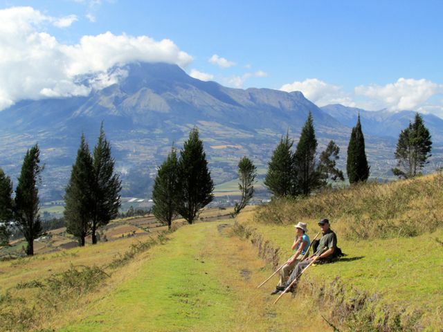 |
| Elin and Dennis resting by the grassy lane |
 |
| View of goats and mountains from the resting spot |
 |
| The goats were tended by indigenous kids, who borrowed Dennis's lighter (they had used up their matches) and huddled against the wind to get a fire going in order to cook some peas. |
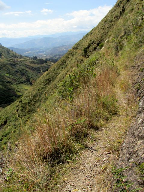 |
| Part of the hike was on a very narrow trail on a very steep mountainside. Yikes! |
 |
| At first I was pretty nervous -
but by the time we turned around and headed back out I had no problem
with it at all. |
 |
| Flower buds along the trail |
 |
| I was going to crop this pic to show the butterfly better - but I like the flowers on the left too much. |
 |
| Flower along the trail |
I continue to enjoy trying new foods here. Going to the market is always an adventure. One of my new discoveries is babaco. It's a relative of the papaya that looks like a cross between a papaya and a star fruit. It's seedless and has a nice slightly tart flavor all its own. I like it!
 |
| Babaco |
Another fruit/vegetable I like - which isn't new to me, as I've enjoyed it before in Latin America - is the tree tomato. It's used for juice (which I can make now, since a friend lent me a blender!), a dessert (stewed and sweetened) or just scooped out of its skin and spread on toast.
 |
| Tree Tomato - on my plate |
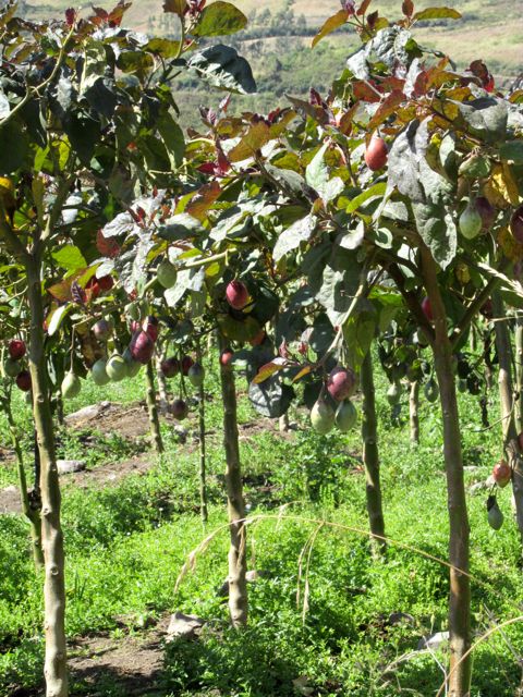 |
| Tree tomatoes on the tree. They grow large orchards of them around here. |
My last blog post included some serious graffiti. Here's some on a lighter note:
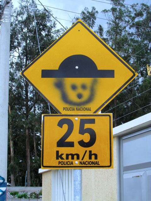 |
| It's actually a warning sign for a tope (speed bump) - the preferred method for slowing down traffic in Latin America. |
On the 21st I checked out going in a different direction in the ravine I led the hike in - but the trail soon came out onto the main road into Cotcachi. But there was still beauty to be seen:
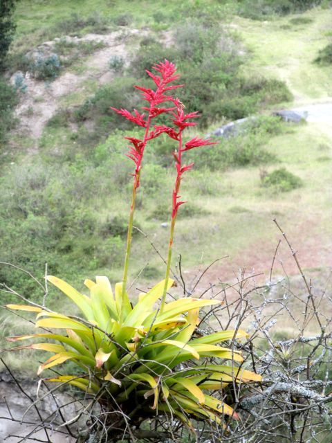 |
| Bromeliad blooming above the ravine. |
It's the dry season here in Ecuador - but that doesn't mean it doesn't
rain at times. The 22nd was the first day, however, that we canceled a
hike because the drizzle just wouldn't stop. Luckily there was a bit of a break when I could hang my laundry on the line to get it somewhat dry before having to move it indoors to finish.
On the 23rd I explored another ravine, on the other side of town, with my friend Kristin. It was lovely, but required a lot of river and fence crossings.
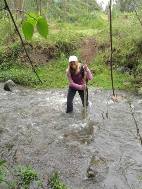 |
| Kristin fording the stream. The water came up to mid-calf - and was chilly! |
Only once in our many crossings was there a bridge - and a pretty flimsy one at that. But it held up!
 |
| Rickety Bridge |
Even getting repeatedly wet couldn't keep us from enjoying the exploration of another beautiful place.
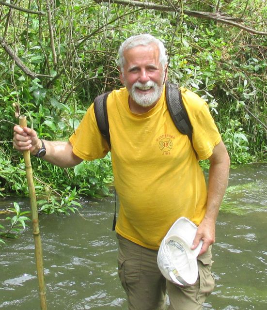 |
| Crossing the stream with the aid of my bamboo walking stick (found on another walk). |
On the way back from the hike, Kristin & I stopped at the market
in the courtyard of the Roca Solida (Solid Rock) Cafe. Delicious
cheeses, quite different from the rather bland soft cheese usually
available here, was for sale. I sampled several, and bought a little
less than a pound of tasty Fontina for $7. What a treat!
On the 24th, friends Dennis & Elin and I did another exploratory walk. We
took a bus to the nearby village of Imantag early in the morning and then
walked up country roads into a valley that climbs the slopes of Mount
Cotacachi.
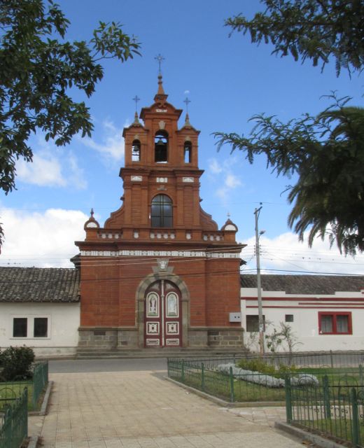 |
| Church on the plaza in Imantag - in a very different style from the usual 2-towered churches in Ecuador. |
We walked up, up, up the road, which luckily was not very steep, enjoying the views along the way. Dennis was able to use his smartphone to check GoogleMaps when we came to junctions and needed to decide which way to go
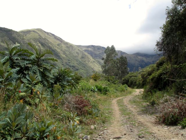 |
| Road winding up the valley. |
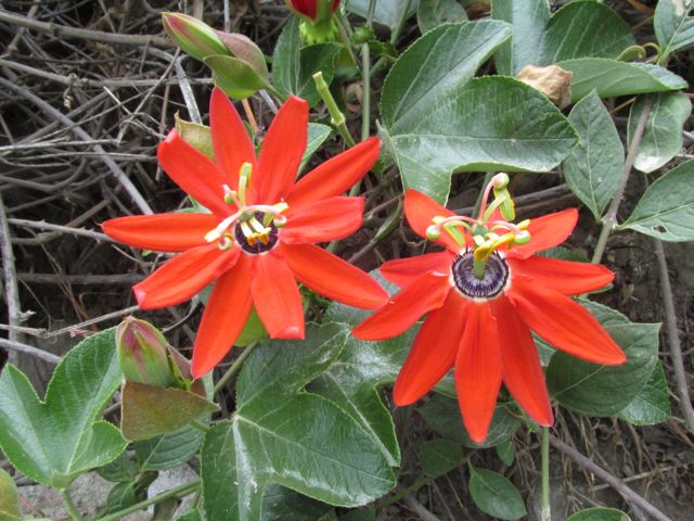 |
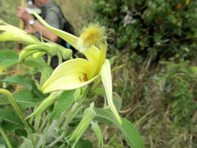
| Red passionflowers. They come in many colors. |
 |
| View from the road |
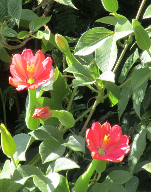 |
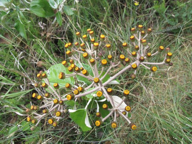
| Close-up of the kind of flowers seen in the foreground of the previous photo |
As we walked up the road, we came upon thousands of these beautiful little butterflies flying low over the road and up around the bushes and trees. There were so many that it reminded me a bit of the monarch butterfly reserve I had visited in Mexico.
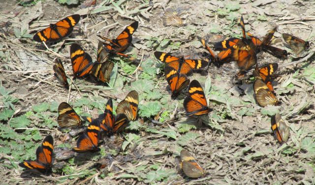 |
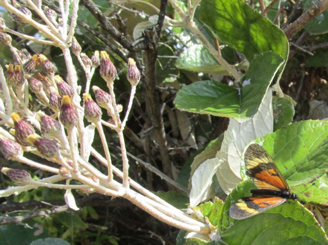
| Actinote Butterflies |
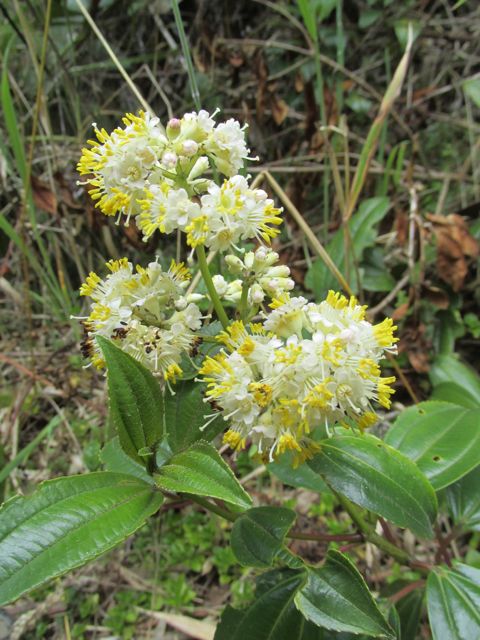 |
| White & yellow flowers along the road |
We walked up the valley for about 4 hours, until the trail that the road had become petered out at a friendly indigenous farmer's potato field. We chatted a bit with the elderly farmer as we ate a bit of lunch, then headed back down the valley. We walked for another 2 hours - then jumped at the chance to ride in the back of a truck back down to Imantag.
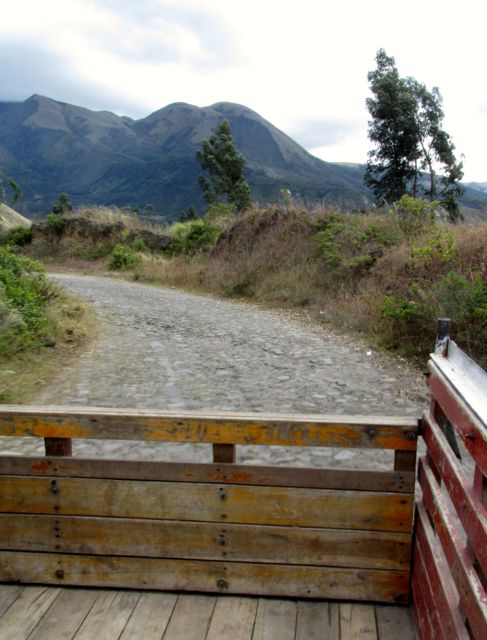 |
| View from the back of the truck |
Today, the 25th of July, has been a lazy day dedicated to updating this blog - after I caught a view of new snow on the peak of Mount Cotacachi: